ENGEOSOFT

Easily import the whole Industry

About Engeosoft

Our services allow accurate and cost-effective data collection that proves to be an important input for planning and designing of 3D LiDAR, Digital Photogrammetric, Orthophoto process, GIS, Remote sensing , Engineering and IT projects. We believe in developing long term relationship with the clients by providing quality services as per project requirements at cost effective prices with fast turnaround, we are flexible to put our best effort round the clock to collaborate our customers for mutual development and benefits.

What We Do

We Specialize In The Areas

Engineering Services

Engineering services innovate, design, and optimize solutions for a better, smarter world. Precision, progress, excellence intertwined.

Contact Us

Geospatial Services

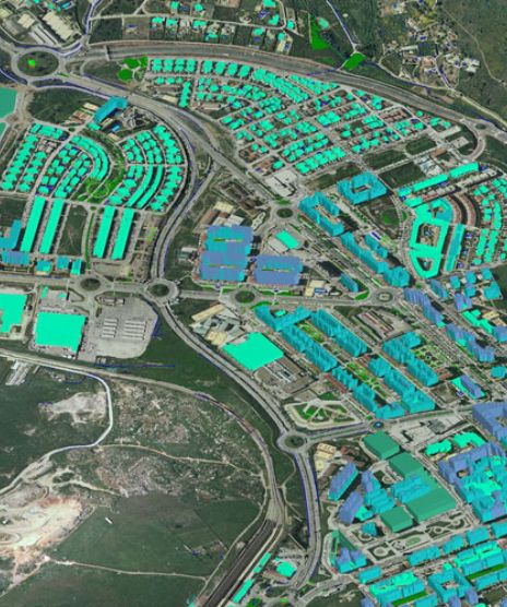
Geospatial services map Earth's intricate details, from navigation to resource management, shaping tomorrow's landscapes.

Contact Us

Software Services

Software services craft digital realms, powering efficiency, and innovation across industries, shaping modern experiences.

Contact Us
Process

Our Mission and Vision

Mission

Empowering progress through a triad of excellence. Our mission is to engineer innovative solutions, provide precise geospatial insights, and optimize IT landscapes, enabling clients to thrive in a digitally interconnected world.

Vision

Pioneering a transformative vision, we envision seamlessly intertwining engineering, geospatial, and IT realms. Our goal is to be the vanguard of integrated solutions, propelling industries forward into a harmonious and technologically enriched future.

Get an easy quotation for your industry

+91 8093467277

Call Us Now

Our company offers a comprehensive range of services, including engineering solutions, geospatial services, and IT services. These services are designed to address diverse client needs and support various industries.

Certainly. Our engineering services encompass a wide spectrum, including civil engineering, structural design, mechanical engineering, and electrical engineering. We specialize in designing innovative solutions for infrastructure projects, industrial facilities, and construction projects.

Our geospatial services utilize cutting-edge technology to collect, analyze, and interpret geographic data. We offer GIS mapping, remote sensing, spatial analysis, and geographic information systems consultancy.

Our IT services include software development, network infrastructure, cybersecurity, and data analytics. We ensure that our IT solutions seamlessly integrate with our engineering and geospatial services, providing holistic and technology-driven solutions for our clients’ projects.

Review

Testimonials

our customer say

Raj Rajesh

Ramesh

Himanshu

Business Analytics

Providing solutions of every kind.

Capitalise on low hanging fruit to identify a ballpark value added activity to beta test.

Lorem ipsum dolor sit amet, consectetur adipisicing elit, sed do eiusmod tempor incididunt ut labore et dolore magna aliqua.

Miranda H.

Founder

963. 369. 265. 56

Make An Call

Engineering, Geospatial, IT: Innovate Your Tomorrow.